|
|
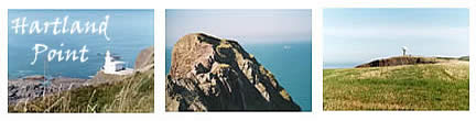
Exploring the Hartland Peninsula. From Bideford
the A39 passes by Higher Clovelly then winds round close by the site of
Clovelly Dykes. Be on the look out for the brown tourist board signs and
turn right onto the B3238 to Hartland. Follow the signs to the Lighthouse
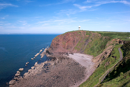
and Hartland Point which is located on the tip of the peninsula where the
mighty Atlantic Ocean meets the Bristol Channel. The road winds its way
up hill and down across the countryside until you eventually reach a kiosk
on the left which is at the entrance to the Hartland Point car park. There
is a small charge per car. The road and the Lighthouse are closed to the
public due to the danger of frequent rock falls, however, from here there
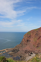
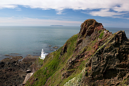
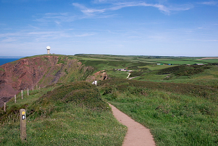
are extensive views from Barley Bay across to Lundy Island it is a short
walk from the car park up to the coastal path where you can catch sight
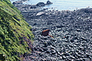
of the Lighthouse and shipwreck 350 feet below. There is now only one piece
of the wreck of the Panamanian ship, Johanna, which ran aground just west
of the Hartland lighthouse in 1983. You can see why this area became known
as the "Wreckers Coast" by visiting the Shipwreck Museum at Hartland
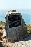
Quay. Further along the coast path you will find a memorial stone which
is dedicated to those who died following the sinking by torpedo of the Glenart
Castle Hospital ship 20 miles from Hartland Point on 26th February 1918.
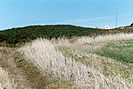
Although the Point is very remote, visitors and South West Coastal Path
walkers can take a break and choose from a selection of local fayre at the
Hartland Point Refreshment Kiosk which serves hot or cold food and drinks,
cream teas, local ice-cream and delicious home-made scones and cakes. According
to the information board nearby Hartland Point is the most extreme north-westerly
point in Devon and is locally quoted to be "furthest from the railways"
being 14 miles from Bude and sixteen from Bideford, as the crow flies. The
Point marks the south-westerly limit of the Bristol Channel. The north-westerly
limit being St. Ann's Head near Milford Haven, 48 miles away. The location
of the Point makes it an important place for communications and navigation.
Hartland Point Lighthouse was built in 1874 and was manned until 1984 when
it was automated. The Lighthouse, which is maintained by Trinity House Lighthouse
Service, warns mariners of the Hartland Point headland and acts as a way-mark
for vessels navigating the Bristol Channel. The large expanse of sloping
concrete at the edge of the car park is a disused water gathering system
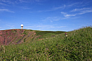
for supply of fresh water to the lighthouse. The Coastguards Lookout was
manned until 1983 when the "watch" was moved initially to Hartland
and then to Swansea in 1988. The coast guard surveillance is now totally
electronic by radio transmitters and receivers. It is only in certain types
of bad weather that a human eye is needed to keep watch at this station.
During World War Two and afterwards there was a radar station at the Point,
which was part of RAF Hartland. It was used to plot both low flying aircraft
and shipping. Remains of the concrete bases of the radar gantries can still
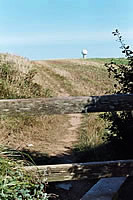
be seen near the modern radar dome, which was erected in 1994 and is used
for air traffic control.
Hartland Point Refreshment Kiosk is open daily
from Easter to the end of September from 10am - 5.20pm. Car Park open from
9.30am. Lundy
Island is 12 miles north west of Hartland Point. Hartland Point is
350 feet above the sea. Be Prepared: The South West
Coast Path is a National Trail, designated by the Countryside Agency, managed
and maintained in the area by the Northern Devon Coast & Countryside
Service and the National Trust. Before setting out we recommend you visit
the Northern
Devon Coast & Countryside Service web site for helpful links, information
on safety and public rights of way. The ANOB
have a variety of guided walks throughout the year. |
| Lundy
high, sign of dry Lundy plain, sign of rain Lundy low, sign of snow
|
|